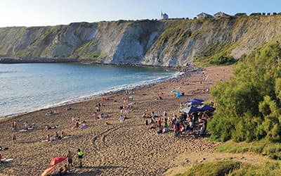
Cliffs of Bizkaia

WATER
January 2025
Beaches, lighthouses, picturesque coastal towns, whale watching and the unique hermitage of San Juan de Gaztelugatxe are just some of the attractions of the Bizkaia coast.
However, the 40 kilometres of coastline between Getxo and Bakio hide another gem: Places of Geological Interest
It is a succession of cliffs. The rocky coastline is occasionally interrupted by small estuaries.
The Uribe Kosta geosite is located between the towns of Getxo and Gorliz, very close to Bilbao.
There are two distinct areas: the coastal cliffs and the estuary of the river Butroe.
The first shows different sand accumulations, including a deposit between the town of Barrika and Muriola beach, the 93 Arenas de Barrika Site of Geological Interest (LIG).
It is made up of fine to medium-grained quartz sand in white, yellowish and orange tones. The area is located within the Kurtzia archaeological presumption area where a prehistoric flint workshop dating back 80,000 years.
These Muriola dunes hanging over the Barrika cliffs are of great geological and archaeological interest due to their unique characteristics on the Cantabrian coast. They are a showcase of climatic variations, as well as bearing witness to prehistoric human occupation.
Close by is the Gorrontatxe stratotype. There are only 75 stratotypes in the world and three of them are in the Basque Country: two at Itzurun beach (Zumaia) and the third at Gorrondatxe.

Accessing the municipality of Getxo, from Bilbao along the so-called ‘Avanzada highway’ (BI-637). Leave the road at a wide roundabout that indicates the exit towards Berango. From this exit, take the BI-634. After about 300 m, at another roundabout, take the first turning on the right (Estrada de Ormaza).
From there, the road is signposted with indicating Azkorri beach, the name by which Gorrondatxe beach is also known. The importance of the Gorrondatxe beach LIG lies in the fact that the Lutetian stratotype is located here. The Eocene stratotype of Gorrondatxe was awarded in 2012 by the International Commission on Stratigraphy, and so was indicated by a plaque and the famous golden nail among its strata. It is easy to find the indications.
In Lemoiz, and more specifically in the district of Armintza, the cliffs are characterised by their black flysch, formed in ancient times at a depth of more than three thousand metres in the absence of oxygen. It appears in layers of ochre sandstone, with reddish tones due to the presence of iron, and layers of black shale. A stroll along the harbour or the beach at low tide is enough to see it easily.

Dust from the meteorite that wiped out the dinosaurs, in Sopela
Between the beaches of Arriatera and Atxabiribil, in Sopela, there is a thin layer that bears witness to the brutal impact of the meteorite that created the giant Yucatan crater and wiped out the world of the dinosaurs 65 million years ago. It is called the K/Pg boundary or the K/T boundary. It is the bookmark that separates the Cretaceous from the Tertiary.

Fruiz, vestige of volcanic Bizkaia
Leaving Fruiz in the direction of Mungia, on the right, a few metres from the road, is the Aldai quarry. It is a display of crystallised lavas forming heptagonal, hexagonal or pentagonal tubes. Long prisms that form vertical columns of about half a metre on each side.
They bear witness to the fact that around 80 million years ago, the sea floor broke open and magma rose through the cracks, cooling and fragmenting to form the basalt columns that can be seen next to the road to Fruiz.

ITURGITXI
RESTAURANT
Traditional Basque recipes in a family atmosphere. Wide variety of menus for celebrations.

SAS78shop
FASHION
Fashion, fashion and more fashion
Insta: @sas78shop
You may be interested…
The Lea mills route
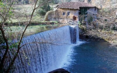
The spell of water
The Txiringuito on Arrigunaga beach
Unforgettable sunsets overlooking the sea
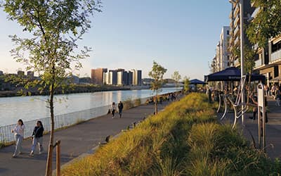
The Deusto Canal Walk
Enjoy the sunset in Bilbao